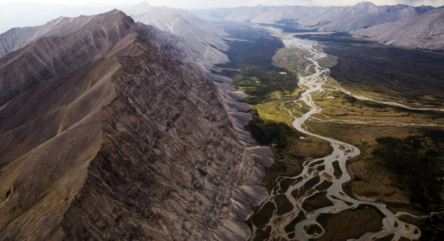


The Peel Watershed drains 14% of the Yukon Territory Canada and flows into the Beaufort Sea via the Peel and then Mackenzie Rivers. While the lower part of the Peel River and its confluence with the Mackenzie River are in the North West Territories, most of the watershed, 68,000 km2 out of 77,000 km2 is in the Yukon.
In 2004 a land use planning process for the Peel River Watershed was initiated. Seven years of public planning was conducted with input from the affected First Nation governments (the First Nation of Na-Cho Nyak Dun, Tr’ondёk Hwёch’in, Vuntut Gwitchin First Nation, the Gwich’in Tribal Council), Yukon Government and communities. A Final Recommended Plan for the Peel River Watershed was produced in July 2011. This plan recommended that 80% of the watershed be protected (55% permanent, 25% interim) and that 20% be opened to development. The affected First Nations called for 100% protection but agreed to compromise and support the plan’s recommendations.
Yukon Government then made a move that derailed everything. At the final stage of the process, Government replaced the Final Recommended Plan with a plan of their own, developed behind closed doors. Government’s plan opened 70% of the Peel River Watershed to development.

To check you in, we need to ask your browser to verify your location.